

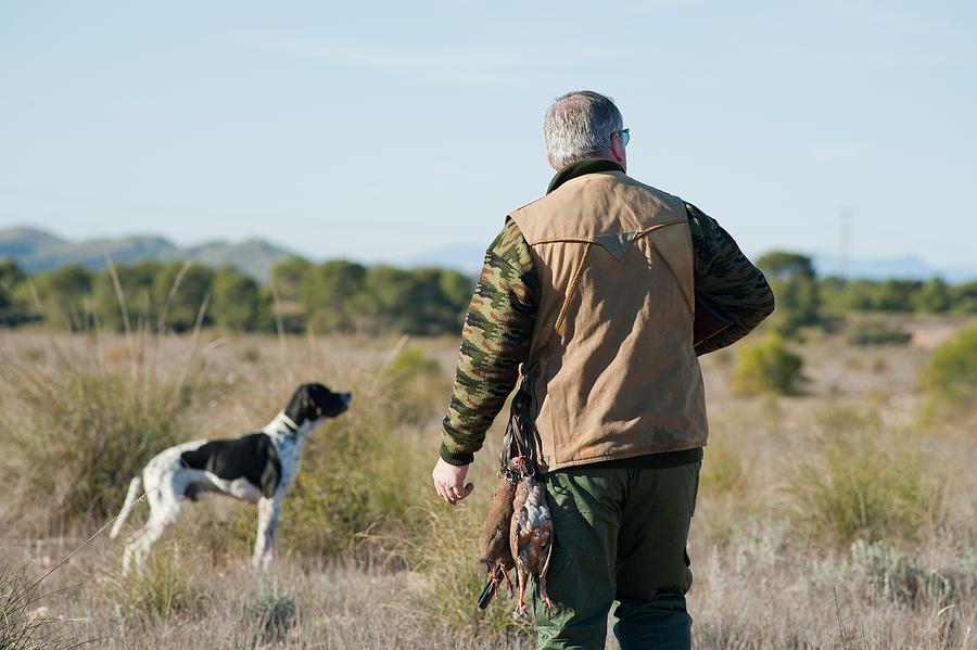
The Trump administration is sending a clear message to outdoorsmen and women. Get outside. Federal lands, which belong to the American public, have never been more accessible and easier to go afield.
So, hunters … go ahead and plan that hunting trip. Think about new areas for the fall duck season. Plan to explore new areas for the fall deer hunt. The Department of the Interior is making monumental strides to ensure that public lands belong to the public — including hunters. Lace up the boots, pack up the shotgun or rifle and know that this land is your land.
More Openings, More Opportunities
Just last month, the DOI announced plans to purchase more than 5,000 acres of land across three states to increase habitat for waterfowl. The new land purchase was included in a larger plan that announced $44.79 million in North American Wetlands Conservation Act funding has been approved by the Migratory Bird Conservation Commission, providing the U.S. Fish and Wildlife Service and its partners the ability to conserve, restore or enhance 185,203 acres of critical wetland and associated upland habitat for migratory birds across the United States, according to a press release from DOI.
The newly purchased land includes more than 3,500 acres near Texas’ Moody National Wildlife Refuge, over 1,600 acres near Virginia’s Rappahannock River Valley National Wildlife Refuge and 76 acres near Illinois’ Emiquon National Wildlife Refuge, according to the announcement, a major boon for public access to hunters and outdoorsmen and women.
“The North American Wetlands Conservation Act is among our most successful tools for the conservation of migratory birds throughout the United States,” said Secretary of the Interior Doug Burgum. “These projects will enhance or establish areas for hunting, fishing and birdwatching, uplift local economies and improve access to outdoor recreation opportunities on public lands for all Americans.”
Get Outside and Park It
That announcement came on the heels of DOI’s implementation of Secretarial Order 3447, which opened more hunting and fishing opportunities in about 75 locations from Maine to Florida to Alaska. Some changes include extending hunting seasons, opening areas to using hunting stands and dogs or using vehicles to recover harvested game. Others including opening National Parks Service lands that were previously unavailable for hunting.
The NPS announced that 36 park system units rescinded 114 unnecessary closures and restrictions. That’s given way for increased hunting access. Some changes were identified for removal because they duplicated state wildlife regulations, repeated existing federal requirements or imposed restrictions beyond what was necessary to comply with law or for public safety or resource protection.
By removing outdated or duplicative requirements, the NPS is making it easier for hunters to understand applicable rules while respecting the primary role of states in wildlife management, a press release detailed.
How to Get There and What to Do
The DOI is also making it easier for public land hunters to know exactly how to get to the areas they want to explore and what’s allowed when they’re out there. The DOI announced a new public-facing mapping tool, which is part of the implementation of the NSSF-supported Modernizing Access to Our Public Land Act and the Modernizing Access to Our Public Waters Act.
The MAPLand and MAPWaters Acts direct federal agencies to digitize and publish key recreation access information — such as roads, trails, easements and waterway access points — in standardized formats, according to DOI’s press release. Historically, this information has often been fragmented or difficult to access.
That’s getting a much-need overhaul and just in time for June’s kickoff of Great Outdoors Month. Interior Department and partner agencies have begun publishing new datasets, including easement information, with additional recreation access data to follow. These datasets will ultimately be accessible through a centralized mapping platform. When complete, the effort will provide clearer, more consistent information on:
- Where public access is available
- Which roads and trails are open or closed
- Seasonal restrictions and allowed uses
- Areas where activities such as hunting or recreational shooting are permitted or limited
“By improving access to reliable, up-to-date information, we’re supporting outdoor recreation, reducing confusion on the ground and helping people make the most of the lands and waters they own,” Secretary Burgum said in the press release. “Outdoor recreation is a cornerstone of many local economies and a way of life for millions of Americans. These improvements will help people spend less time searching for information and more time enjoying the outdoors.”
After all, public lands belong to everyone, hunters included. Enjoy it. This land is your land.
Larry Keane is SVP for Government and Public Affairs, Assistant Secretary and General Counsel of the National Shooting Sports Foundation.
Glad to see these developments. We also need to get the US Army Corps of Engineers to allow concealed carry on the lands and waters it owns and/or manages. Their policies prohibiting that carry are 2A infringements that are not backed by any history and tradition at the time of the founding.